This is the transcript of my video on D-day landscapes on Youtube
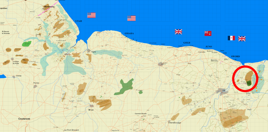
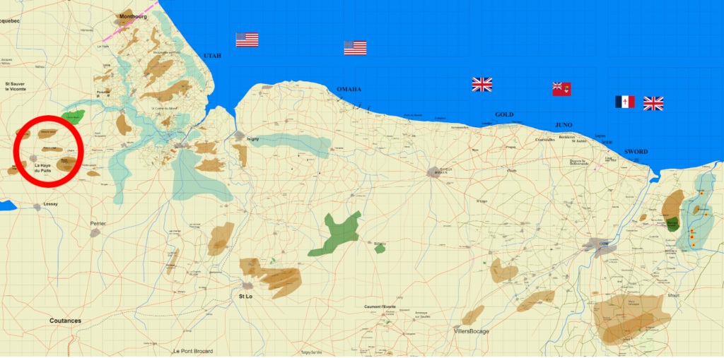
On the 6th June 1944, before the landings on the five beaches, the air borne had landed on each flank. The British and Canadians in the East, and the Americans in the West. An important feature of the terrain were rivers and canals. Bridges crossed many Rivers and canals. The allied soldiers captured some and destroyed others. D-day landscapes included wide open beaches, cliffs, bridges, rivers, canals, floods, plains, forrests, fields surrounded by hedges, and hills.
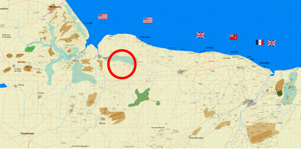
Seven bridges
The first action on D-day was capturing the bridge at Benouville over the Orne canal. The attack at midnight 20, was led by Major Howard who went in with three gliders carrying 30 men each. The first glider landed 47 yds from the bridge, just using a compas and stopwatch for navigation. Major Howard and his men captured the bridge in 10 minutes. Den Brotheridge fell during the attack, the only man killed in the action. That bridge became known as Pegasus bridge due to the arm patch of the airborne.

Two gliders captured the other bridge over the river Orne. The third glider landed near the river Dives.
Rommel had flooded the Dives valley which was the eastern boundary of the airborne.
The mission for the British and Canadian airborne was to take the bridges over the river and canal of the Orne, and destoy the 5 bridges over the Dives. Then to hold the high land between them.
Captain Juckes at Bures
Captain Juckes and his men blew the bridge at Bures. The airborne men let the farmer get a herd of cattle across the bridge before blowing it.
Maj Roseveare carried out the mission to blow the bridge at Troan. As he and his men landed far off course, they commandered a jeep with a trailor from some medics. To get to the bridge they had to drive through Troarn.
The paratroopers firing at a guard woke the Germans who were coming out of the houses firing at the paratroopetrs. One man fell off the trailor, but they got to the bridge and blew it. Roseveare then pushed the jeep into the river and they set off on foot to their next mission.
Four bridges and flooded lanscape
At 1:30 the 101st were going in. Their mission was to capture the land inland of the floods behind Utah and capture bridges and a tidal lock on the river Douve.
The landings were highly dispersed due to the Rebacca reciever being only in the lead plane of 9 planes,
Men were landing in the floods behind Utah, and the floods in the 82nd zone. Some dropped in the channel.
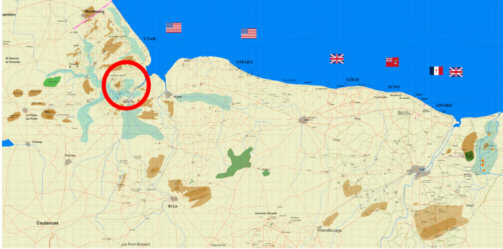
Enough men landed in the right place to carry out their mission of holding the land inland of Utah. Captain Johnson captured the tidal lock at Le Barquette but they couldn’t advance further. Captain Shettle was to capture the two wooden bridges lower down the Douve. The air force detsroyed the bridges on the 7th as Shettle hadn’t managed to.
82nd airborne at 2:30
The 82nd were landing an hour later. They were to capture Ste Mere eglise and two bridges over the river Merderet. The tidal lock that Col Johnson had captured, had been blocked off to make the river flood for over 10 miles. At Chef du Pont there was a bridge to be captured over the Merderet, a tributary of the Douve. It was captured on the 6th, but German artillery on an island in the floods, stopped any advance till the 9th when the artillery of the 90th division arrived.
A few miles up the river Merderet was the bridge at La Fiere. This was a different D-day landscape. That was the objective for Captain Dolan of the 505th. His group had many men added on to help, but that puny bridge was stiff nut to crack.
Col Timmes had taken the other side of the causeway but was now held up in an orchard to the NW of La Fiere. A local told him that there was a lane just below the water surface going across the floods. Timmes sent a messanger across to meet General Ridgway, who sent a battalion of glider men back across the sunken lane to attack the Germans from the rear. That didn’t work out so a direct assault across the causeway finally took the bridge on the 9th. Taking the bridge cost over 500 casulaties including over 250 killed.
As if the war had finished
150 paratroopers and glider men anded up in an isolated village of Graignes in the middle of the marshes South East of Carentan. They lived in peace, fed and housed by the locals, for a few days. The Germans knew that paratroopers were in the town after being attacked. They attacked it on the 11th leading to a masacre of some civilians and paratroopers.
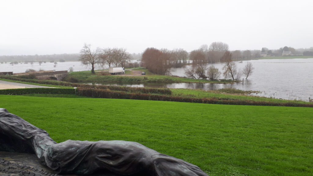
It wasn’t only the airborne that came up against floods. The river Aure that runs through Bayeux, goes towards the sea, as rivers do. But, then it comes up against the cliffs that run from Arromanches to Omaha beach. In normal times the river goes down a sink hole and comes out at the bottom of the cliffs at Port en Bessin,whereas after heavy rain the river turns left and goes over 15 miles to Isigny. That river was flooded by blocking off the mouth of the Aure. The allied troops were supposed to be up to the N13 road by the evening of the 6th. For the troops on Omaha beach it took two days. On the 8th, they were at Longueville and La Cambe, where the German cemetery is now. South of that was another D-day landscape of the few mile wide barrier of the flooded river Aure.
Suprise attack across floods
On the 9th Lt Kermit Miller crossed over the floods with 29 men. They were from Chesapeake bay, so familiar with marshes. They attacked some Germans in a building pointed out to them by a local. The Germans were relaxed, thinking that the floods protected them. Miller’s men suffered some casualties but after a nights rest in a barn, they recrossed the floods with their wounded and some prisoners.

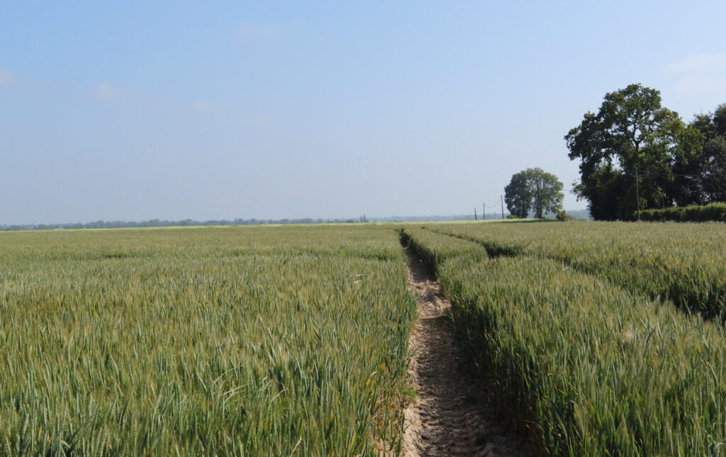
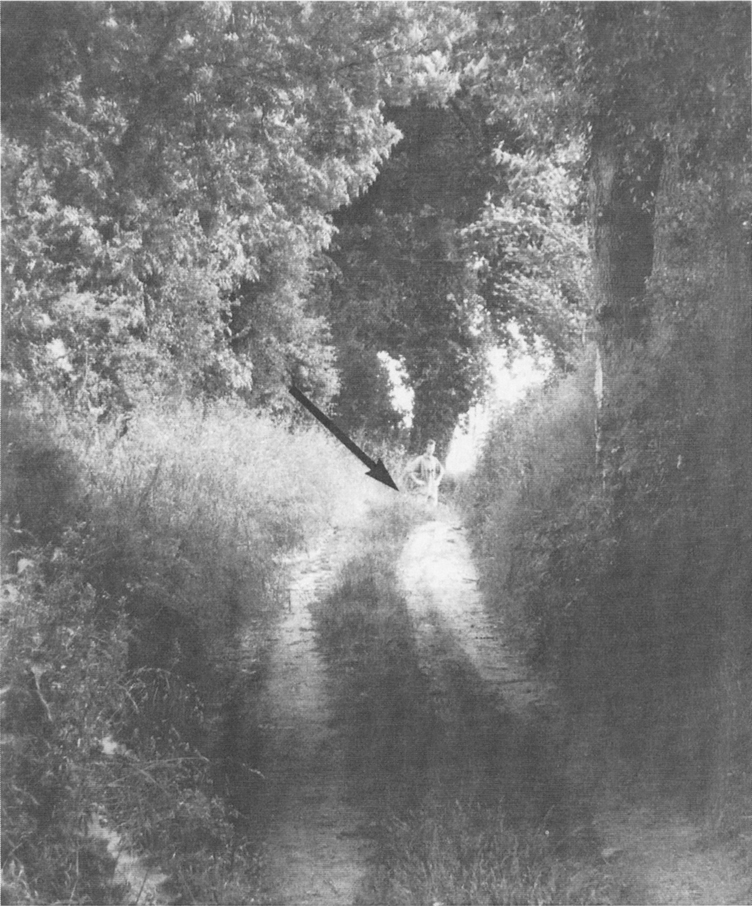
Any body who’s read anything about D-day will have heard of the hedgerows. Small fields surounded by hedges make up the landscape West of Bayeux. French have a generic name for that. Le Bocage. Some of these hedges can be 800 years old. Some are only a few hundred years old.
Hedgerows and hedgerows
When Man started agriculture, whole villages would work the fields together. In the 11th century, times were relatively prosperous and peacefull. There was population explosion. Families started making there own farm and would plant a hedge to mark their land. Later hedges kept herds off of the crops. When roads were just dirt tracks the road would wear down, while the leaves off the trees would build up the humus and earth to make banks. Today tractors trim hedges with a flail, whereas in 1944 they would have been a lot thicker.

The hedges of the D-day landscape were a barrier to tanks. If a tank tries to cross a hedge, the nose goes up in the air exposing the under belly which wasn’t armoured. The tank would also be pushing up the trees instead of pushing them over. In July Sgt Mulin devised a system to overcome this problem. More about that later.
Fields tend to be bigger now than in 44 but in some places there are fields as small as they were then. The paratroopers were landing in the bocage area, if they didn’t land in the floods. Gliders came in after and they had to land in small fields surrounded by hedges.
Machine guns in hedges
A machine gun could be behind any hedge. The worst way to go into a field was through the gateway. German machine guns the other side, would be trained on the gateway. Cows could be a friend or foe in these fields. Being curious, they would go and sniff out the hedge where a machine gun crew was. If you were trying to get through a hedge discreetly, they could come and sniff you out aswel.
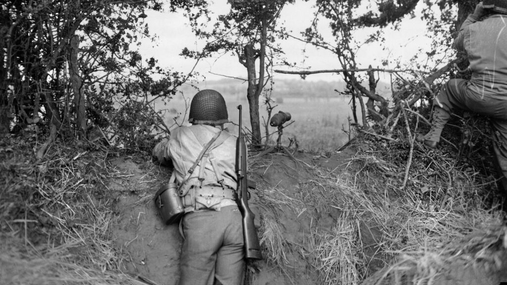
A narrow lane between fields will have a hedge on both sides. The lane might be wide enough for a jeep but not a tank. Combat in the hedgerows was essentially infantry against infantry.
D-day landscapes: Plain of Caen
The British and Canadian sector was principaly on the plain of Caen. What we see above ground depends on what’s below ground. The plain of Caen is a limestone plateau. The Stone of Caen was famous across Europe for building. Westminster abbey was built with Caen stone as was Durham cathedral. The lobby of the empire state building is faced off with Caen stone. There is still a quarry exploiting Caen stone south of Caen. The galeries of these mines and quarries were used by the civilians as shelters during the battle.
The limestone plateau drains easily, so trees don’t grow too well. The landscape is very open. West of Bayeux the limestone dips and is covered in clay, which retains water, so more trees and hence the Bocage;
On first sight the plain of Caen looks easy to advance across.being open with few trees. But, advance was difficult for the opposite reason that the hedgerows were difficult. you could be seen from miles away. The dreaded 88mm gun had a max range of 12 miles, it was accurate to 7 miles and could knock a tank out at 1 and a half miles.
Bavent wood
The highland between the Orne and the flooded Dives became the front line for the British airborne and the commandos till august. Bavent wood was no mans land. Both Germans and British would send in patrols to make sure the other side wasn’t installed in it.
Rivers impeded progress. Another barrier was hills. Holding hills also gave a tactical advantage. THe allies referred to hills by their hight in meters. There were several Hill 30s. One was near Picauville where Col Shanley held out for three days from the 6th. Another hill 30 was just south West of Carentan taken by the 501st.
Low strategic hill
The highest hill in an area wasn’t necessarily the most strategic. Stanley Hollis was the only soldier to win the Victoria cross on D-day. He was with the green Howards and attacking hill 103 near Audrieu south of Bayeux.
Hill 103 was taken without much resitance. The lower Hill 102 was their next objective. Surprisingly the Germans held on to that hill tenatiously. A machine gun team was holding up Hollises mens advance.
It wasn’t obvious from the map , but HIll 102 gave a view right across to Caen making it more important than hill 103.
Hollis decided that two krauts with a machine gun couldn’t hold up a battalion’s advance. He npticed that the Germans used the gun as per regle. They would fire a short burst then duxk down, then pop up and fire. He looked in his musette bag for a grenade but only had some socks in there. He asked his men for a grenade. When the Germans poped up, he lobbed the grenade at them. As soon as he did, he realised he hadn’t pulled the pin out. Most menwould try again later, but Hollis realised that the Germans didn’t know that. They had ducked down when they saw the grenade coming at them. Hollis ran straight after it and caught them crouching in the dug-out.
D-day landscapes: High strategic hill
Hill 112 was just west of Caen and gave a commanding view over Caen. German commander SS-Obergruppenfűhrer Paul Hausser remarked “He who holds Hill 112, holds Normandy”.
The objective for Operation Epsom which was launched on 26th June was to capture hill 112.
The attacking troops had to cross the rIver Odon. The Argylles of the 15th Division advanced using a classic fire and manouvre tactic. The bridge at Tourmauvuille was captured intact. There’s a monument to their exploit near the bridge.
The next bridge allong the river, at Gavrus, was captured unopposed.
Fierce fighting across the northern slopes of the hill 112 were reminiscent of WWI. The hill was taken but a rapid German counter attack repulsed the british. It remained a no mans land till early August when the British took it, after Caen had been taken in operation Goodwood.
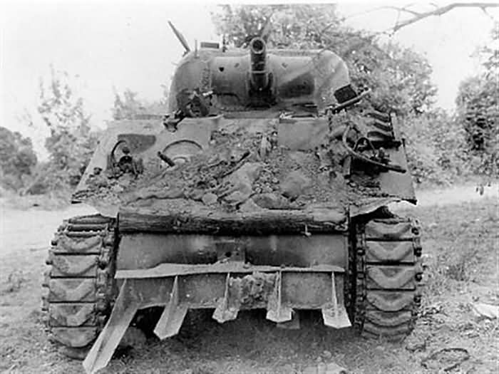
Tanks through hedges
St Lo was supposed to have been taken by D+10. After a slow start on Omaha beach the troops had advanced two thirds if the way to St Lo in 10 days. They were fighting through the densest Hedgerow country.
There are hedges in England but the men weren’t prepared for what they found in Normandy. They had to learn as they advanced. They did develop a foolproof system to get through fields.
Having got across a field they would be up against a hedge with a field the other side, and beyond that another hedge with machine guns in. The tanks would fire into the far corners of the field; where machine guns would be; Mortars would lay down a smoke screen in the field. The infantry would get through the hedge to attack the far hedge. While they were doing this a tank would ram a spike into the near hedge bank, making a hole for the engineers to put explosives in. This would blast a hole in the hedge allowing tanks to get through to back up the infantry. As I said, it was foolproof method, but there would be casualties each time.
Avoid bridges
On this drive towards St Lo the river Elle was an obstacle. Near Ste Marguerite d’elle there were two bridges which would be heavily defended. The decision was made to cross away from the bridges. The Elle could be jumped over by a fit man, but it was not going to be that easy. The Germans had the whole bank covered and the hedges from where the115th were going to start from . The attack started at 5am after an artillery barage, in an hour nobody had got to the river. It took three attacks before a group of men were at St Clair d’Elle.
Just South of the Elle the 29th was put in active resistance. That means not to really try to advance, but send out patrols to harry the Germans and leep them guessing on the Amertcans plans. This was because Bradley had decided that Cherbourg was the key objective for the near future, so everything coming across the beaches went towards the drive on Cherbourg.
A port demolished
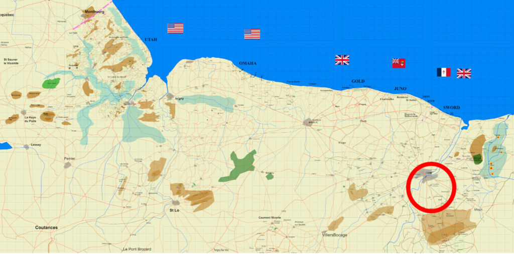
Cherbourg was the objective for Utah beach. It was to be taken in 10 days so it could be used to bring in supplies. It actually took three weeks. A lot of the Cherbourg peninsula was Bocage but towards Cherbourg the lanscape was more open but with several ridges which formed good lines of defense for the Germans. Overlooking Cherbourg was Mont Roule. , 117m high. The French had built a fort on it to protect against the centuries old enemy, England. The Germans used it and also built some casemates dug into the cliff face.
The Americans couldn’t get into the casemates from inside the mount , or climb up to them. They decided to lower explosives down from the summit, so they would explode at the level of the casemates. Von Schleiben surrendered on the 26th June.
D-day landscapes: The Mahlman line
Some hills higher, or more remarkable than others were called Mounts and a name. Or Mont in French. Mont castre, Mont Doville, Mont Eterclin and Mont Gardon were a line of hills across the base of the Cherbourg peninsula.
Early in the war, General Mahlman had the idea of using these hills as a defense line. Nothing was done until the invasion, the Germans started installing the defenses on this Mahlmann line.
The Americans knew nothing about the Mahlman line till the interrogation of a captured German officer. He wasn’t going to give any information about anything. But they found a photo of him and a prostitute in his belongings. They threatened to send the photo to his wife. He told them all he knew.
Knowing about the Mahlmann line didn’t make it any less formidable. The 79th division, the 82nd airborne and the 90th division had the task of taking it. Mont Castre was the toughest part of this defense line. The 90th slogged from the 4th July till the 12th to take it.
Hedgecutters
With Cherbourg secured the drive on St Lo through the hedgerows resumed. Sgt Cullin had come up with a useful tool to get through the hedgerows. He had cut up some Check hedgehogs and welded the steel spikes on to the front of a Sherman tank. The tank could now ram through the hedgerow. If it was on a steep bank the engineers would break into the side of the bank, then the tank could come up and ram through the rest.
Bradley wanted to keep this secret. It was first used in battle on the 14th july in the last push on St Lo. .
Hills surrounded St Lo. So, after the hell of the hedgrows, these hills had to be captured before St Lo could be taken.
The main hills around St Lo were Hill 122 and Hill 192. Hill 192 is 20 miles from Omaha beach, and from the top the Germans could see to the coast.One can see Utah beach on a clear day. That epitomises the advantage the Germans had over the allies.
The 2nd division took the hill 192 on the 11th July. A pre assault artillery barage was laid down, but the Germans knew what that meant and moved forward. Nevertherless the 2nd division took it by the evening. The 29th were attacking on their right into St Andrée L’Epine.
From Hill 192 it takes 5 minutes to drive into St Lo, but it took them another week to get into the town.
Breakout
With St Lo being secured Bradley could launch operation Cobra. The idea was to drop 5000 tons of bombs on the Germans, to break through their resistance. Even though bombs were dropped on the American troops the operation worked and Patton was at Avranches 6 days later. It had taken 6 weeks to cross the 20 miles to St Lo from Omaha. Now the 35 miles to Avranches were covered in 6 days.
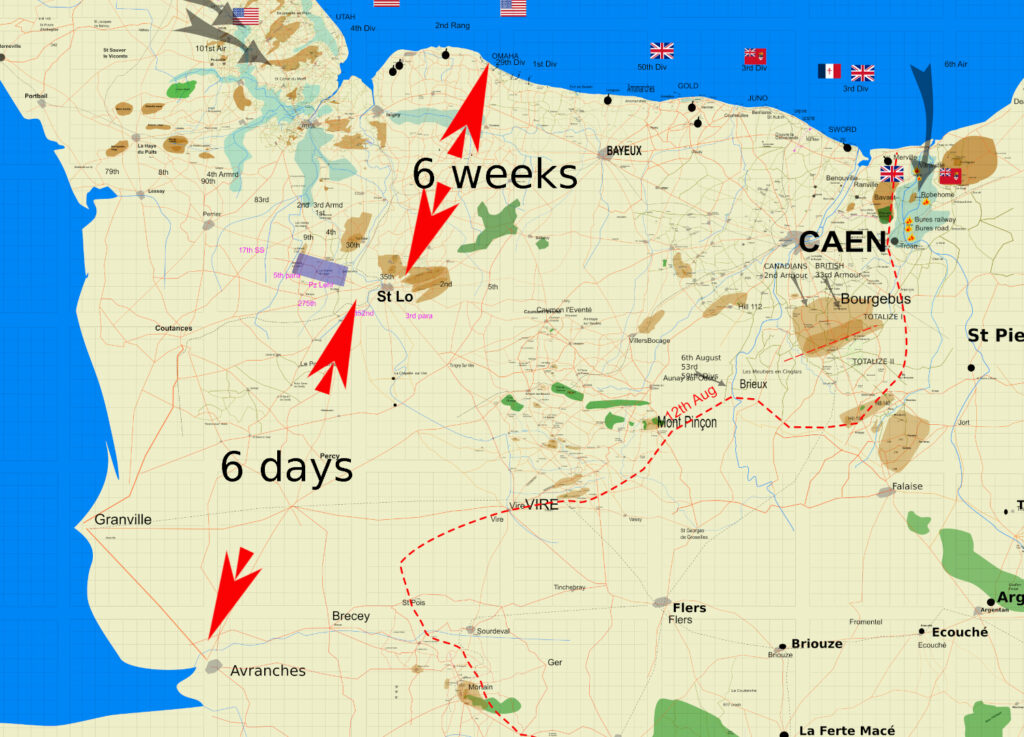
Hastily planned to coincide with Operation Cobra, Operation Bluecoat had the objective of getting to the Vire to Condé road and take Mont Pinçon. Mont Pinçon was 15 Miles away but took 6 days to get to.. The start line was Caumont L’Eventé, next to the American lines. St Martin des Besaces was taken on the 31st by the 11th armoured division. On the same day a reconnaisance unit of the 2nd household cavalry was advancing 4 miles past
the front line when they found a bridge undefended. This gift was the result of German SNAFU. The bridge over the Souleuvre was at the frontier between the German 3rd parachute division and the 326th infantry division. Each commander thought the bridge was the other’s responsibility. It’s now called the Bull Bridge.
Operation Luttich
With the Americans flowing into Brittany through Avranches, Hitler gave a catastrophic order to Von Kluge. He ordered Von Kluge to retake Avranches. This would cut off the supplies to the American troops now speeding into Britany and Eastwards.
Von Kluge knew he couldn’t do this effectively but had to obey orders. On the 7th August operation Luttich was launched with 3 panzer division racing towards Avranches. The 1st division had taken Mortain and had just handed it over to the 30th division. They found them selves right in the path of the German attack. The 2nd battalion 120th became stranded on hill 314.
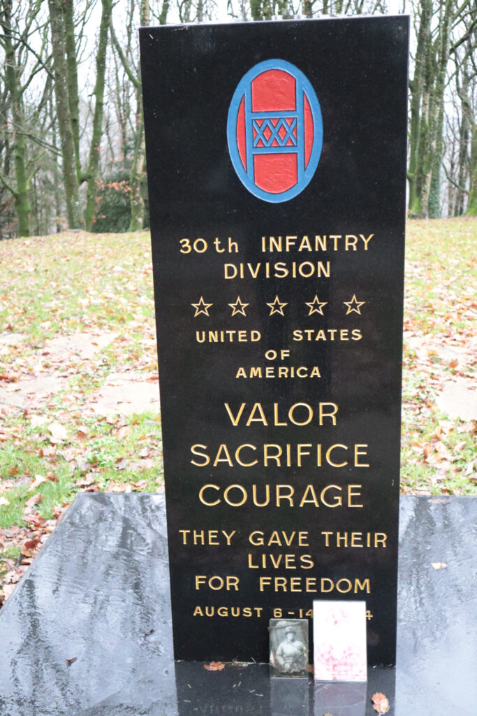
Being on a hill saved them from being overrun by the germans. Observers could direct artillery fire on to the Germans. But they were there till the 12th and running out of food and supplies. They were resupplied by airdrops and even artilley.
A tragic breakthrough
Holding a hill usually gives a tactical advantage, but if it’s the wrong hill, that can lead to disaster. During Operation Totalise, Colonel Worthington of the British Columbia Regiment was given the mission to take hill 195 near Potigny. They set off in the night of the 9th August heading down the straight Caen to Falaise road. Firing was coming from Bretteville le Rabat, so they left the road to skirt round Bretteville. The root of the disaster was another straight narrow road that was a Roman road called the Lane of the Duke. That’s refering to Duke William who became the conqueror. He used it in his flight from assassins near Cherbourg.
The Worthington force crossed over this road going Eastwards without realising, then veering to their right discovered it again and took it for the Caen to Falaise road. They followed it and came to a hill. This must be hill 195. They occupied the hill, satisfied that they’d achieved their objective. They were actually on hill 140 4 miles to the East of hill 195. What was worse is that they were on a hill just vacated by Panzers that had gone out on patrol.
Mistakes compounded; They were attacked by panzers, they were straffed by the RAF, as the pilots didn’t expect allied tanks to be here. Polish armour happened to approach and try to releive them but were repulsed. No information was sent back to HQ as to their real position. A few men managed to break out but the main group was anihilated. If their true position had been relayed to HQ this mistake could have turned into a breakthrough.

The infamous Kurt Meyer had witnessed this action from Mont Joly overlooking Devil’s breach.
Falaise pocket
With Operation Luttich failing the Germans now started retreating. 100,000 men were being trapped in this pocket which became known as the Falaise pocket.
The Canadians and Poles had advanced to St Lambert by the river Orne. The Poles were on Mont Ormel and the Canadians to the North West. The main options for the Germans to get out had narrowed down to the bridge at St Lambert and a ford at Moisy. The RIver Dives which formed the eastern flank of the airborne, is quite narrow here. An athlete could jump over it, but vehicles can’t cross it, not even a tank. The banks are steep and a tank would get jamed. The only option was the bridge or the ford.
Once across the river they ran the gauntlet of the corridor of death. The Poles were firing from the high land on their right and the Canadians from the high land on their left, and allied aircraft were constantly attacking them.

It was a desperate retreat for the Germans, but not completely disorganised. The german commanders used the Gouffern forest near Tournai en Dives to shelter their troops and wait their turn to run the gaunlet. The forest helped hide them from the incessant allied aircraft attacks.
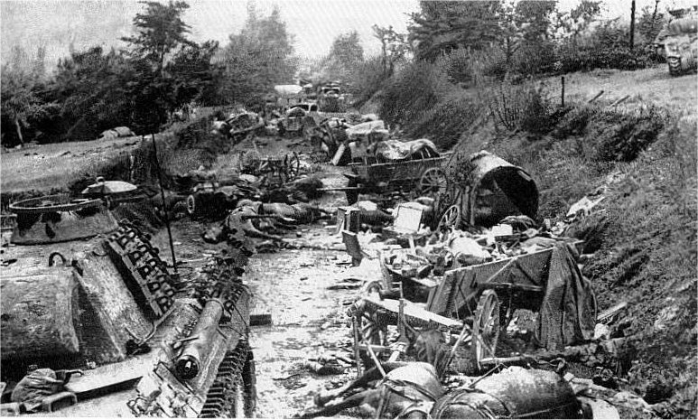
The Falaise pocket closed on the 21st August which marked the end of the battle of Normandy. The vehicles and tanks breaking down or being detroyed on their way to the ford formed a funnel shape area of wrecks which took 15 years to clear away.